Hydrography Day: Navy to apply new technologies in providing Nigerian waters information
The Nigerian Navy Hydrographic Office (NNHO), has expressed its preparedness to provide up-to-date Marine Geo-Spatial information of Nigerian waters to maritime operators, in order to promote economic growth in the country.

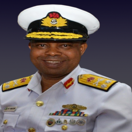
This was disclosed by the Hydrogapher of the Navy, Rear Admiral Chukwuemeka Okafor, while speaking at the 2020 World Hydrography Day (WHD) Celebration, with the theme: “Hydrography – Enabling Autonomous Technologies”.
Boko Haram’s command Centre, terrorists neutralised in Sambisa Forest
According to Okafor, the NNHO will harness new technologies, and collaborate with developed hydrographic offices in the world, to churn out new nautical products and solutions inline with international best practice.
Okafor, who is also the President, Nigerian Hydrographic Society (NHS), stressed that new technologies are key in service delivery, especially as Covid-19 ravages the world, and physical distancing becomes the new normal.
In his remark at the celebration which is marked yearly on June 21, the Hydrographer said that the theme for this year’s celebration was apt, as technology has revolutionized the science of hydrography.
He said: “ From the era of depth acquisition using lead and lines, to more recent technology of multibeam echosounders, the evolution and advancement in the science of hydrography have been rapid and decisive.
“ In today’s hydrographic practice, attention is increasingly shifting to the use of autonomous technologies such as Autonomous Surface Vehicles (ASV), Autonomous Underwater Vehicles (AUV) and flying drones to acquire high accuracy, high-resolution marine geospatial information to meet evolving hydrographic applications.
“ Most developed hydrographic offices are developing autonomous hydrographic capabilities of national and global Blue Economy programmes, with the United States’ National Oceanic and Atmospheric Administration (NOAA), Office of Coast Survey (OCS), the United Kingdom Hydrographic Office (UKHO) and French Hydrographic Office (SHOM), leading the charge.
“ In the light of the current Covid-19 pandemic, NOAA’s OCS is deploying unmanned survey launches and survey vessels to work in the most treacherous weather and ocean conditions, with their survey crew members operating remotely.
“ As the Nigerian Navy (NN) is ready to induct a state-of-the art offshore survey vessel, with autonomous capabilities in the next few months, the NNHO is fully poised to provide up-to-date marine geo-spatial information of Nigerian waters to diverse maritime operators, for enhanced economic growth of our dear nation.
“ To this end, the NNHO has increased collaborations with developed hydrographic offices, like NOAA, UKHO and SHOM, in order to tap from their experiences toward churning out new nautical products and solutions in the most internationally acceptable format.
Accordingly, the NNHO will soon release to the public, a suite of new generation navigational services such as High Density (HD) charts and high-resolution bathymetry products among others. ”
Speaking further on WHD celebration, the Rear Admiral maintained that hydrography is a force multiplier to human survival and sustainability.
He said that NNHO as the national charting authority in Nigeria, will also cooperate with the hydrographic industry’s best under the umbrella of the NHS, to further enhance its services.
He further canvassed for collective effort, toward protecting and preserving the ecosystem, and the blue economy.
“ This is for the purpose of improving the standard of hydrographic practice, methods and technologies among private hydrographic practitioners so that Nigeria can draw maximum benefits from the Crowd Sourced Bathymetric initiative of the International Hydrographic Organization (IHO).
”This would go a long way to facilitate quicker survey and chart coverage of Nigerian waters, and ultimately place Nigeria on the right stead towards actualizing the Nippon Foundation/GEBCO seabed 2030 project.
“ Indeed, these are exciting times in the field of hydrography in Nigeria. While mankind grapples with global pandemics and the attendant uncertainties that come along with it, a new generation of hydrographers are being born; ones who are developing requisite skills and abilities, as well as harnessing more modern technologies to tackle and surmount challenges that hitherto exist.
“ The need for autonomous technology in hydrographic applications to achieve and ensure these processes is being brought to the forefront, and we as a nation, and indeed all hydrographic community must come onboard to ensure the sustenance, protection and preservation of our oceans ecosystems and the blue economy as a whole,” he said.
While commenting on the many achievements of NNHO, the Hydrographer said that NNHO will not be complacent in any way, but increase the desire to improve capacity and capability consistently in support of Nigeria’s maritime sector and blue economy programme.
In his words: “ As you are aware, during the last WHD Celebration, the NNHO published the first indigenous navigational chart ever produced by Nigeria; NG 2501 (Lagos Harbour Chart) with much fanfare. This feat completed Nigeria’s hydrographic capacity development as required by the IHO. As at today, the Office has published the second edition of the chart, incorporating recent navigational significant changes that have taken place within the channel.
“ The Office has also published the second indigenous navigational chart, NG 4401 (Ogunkobo to Tin Can Island) at a time when it was most needed, primarily because the water within the area had hitherto never been charted and had recently witnessed several marine accidents. This achievement drew several commendations from top military echelons, as well as the Federal Government and mariners who expressed delight to the usefulness of the chart to their vouyages.
“ Early this month, the NNHO and indeed Nigeria, recorded another mile stone in hydrographic capabilities, with the acceptance and publication of Nigeria’s first Electronic Navigational Chart (ENC), NG525010, by the International Center for ENC (IC-ENC).
The electronic version of Nigeria’s Second indigenous navigational chart; NG 4401 is set to be released soon. ”